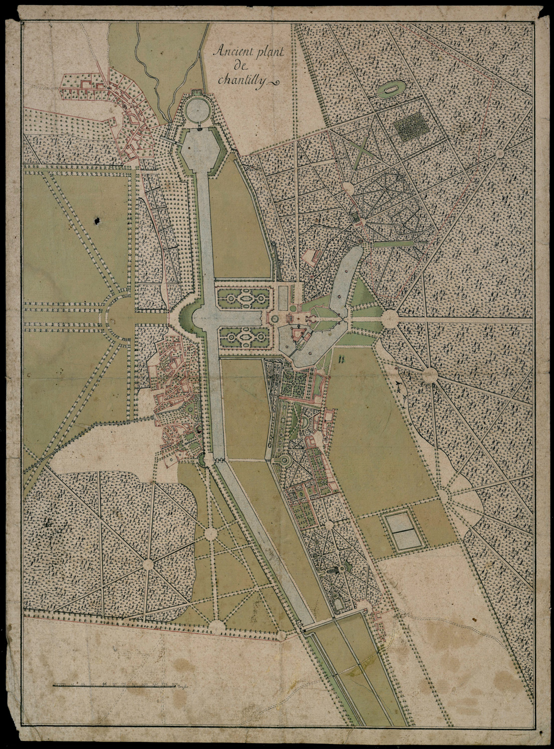

The Domaine de Chantilly in the 17th century
- Localisation :
- Année de création :17th century
- Artiste :
Description
Old map of Chantilly
Waterproof map on paper, (62 cm X 46 cm)
The Maps and Plans Room, CP-B-0075
Architects, gardeners and topographers regularly depicted the domain of the Condé princes. These maps are precious as they show the appearance of the domain which was greatly changed after the French Revolution. Only Le Nôtre’s flowerbeds remain in the axis of the Grand Château.
After 1682, this map attributed to Jean-Nicolas Breteuil, the Prince of Condé’s surveyor, shows the entire Domaine de Chantilly at the period straddling the 17th and 18th centuries. The Great Stables, the Château d’Enghien and the Jeu de Paume had not yet been built.